Severe Thunderstorms in Low
Instability
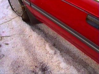
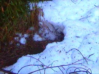
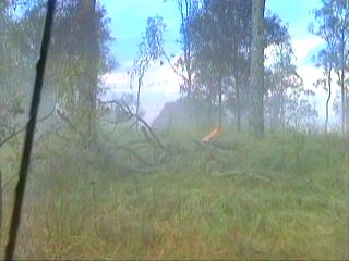
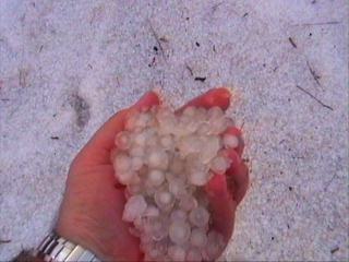
Ok...time for another situation, this was a nice day with a storm moving rapidly SE between Amberley and Warrill View bringing one foot hail drifts and plenty of trees down! Perhaps the most impressive things were that the storm moved quickly yet brought so much hail! Check out the chase report if you're interested! A few captures...
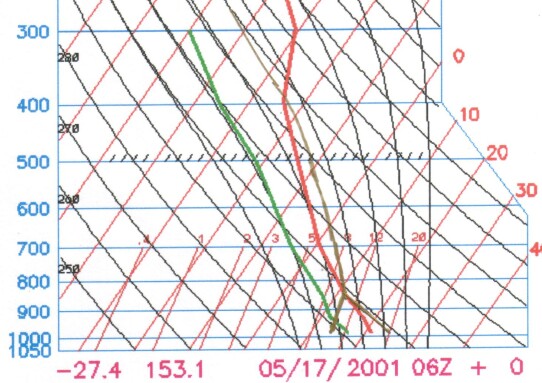
(No it's not snow, it's all hail!) Anyway...onto the analysis...first some instability, lets have a gander at a Skew-T!
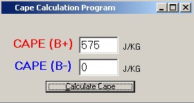
Hmmm...well, we have a bit more instability than the last situation at least! Still not that great, LIs are -2 though...but they're fairly consistently -2 throughout the instability region. One thing that is important is how the instability is stretched out, for instance lets see what CAPE is like...
575...not exactly fantastic! But most of the CAPE is between 800mb and 400mb, and that actually helps us a bit. How? Well, the CAPE is "compressed." For instance, say the CAPE was spread from 900mb to 300mb, well because CAPE is simply a function of area underneath the Skew-T, if we make the length longer (depth of instability), we must make the width shorter (strength of instability at a given point). See what I mean? So you can have two situations where CAPE is the same, but the situation that has the CAPE in a more confined area tends to be the one that would give you stronger storms! Ok...so the shear and setup...
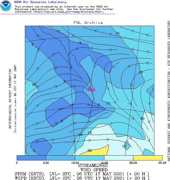
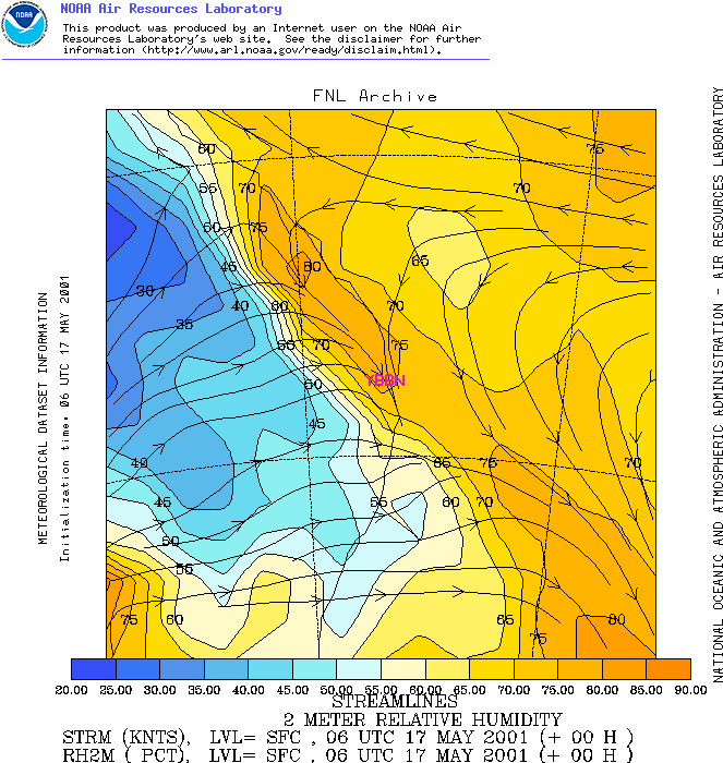
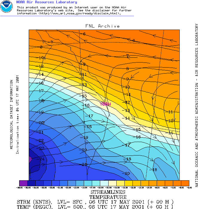
Wozers...trough is right over Brisbane and there's some nasty westerly winds pushing in...already not looking that crash hot! But still...we've seen the proof and we know what happened! However westerlies aren't always bad...it's often important to look at the surface moisture too. I didn't save any specific humidity charts, so we'll have to look at an archived surface humidity one!
You can see it does dry out just behind the main trough, so this was a big help to us! It didn't dry out straight on the trough like it often can. So with that, lets look at the remainder of the levels.
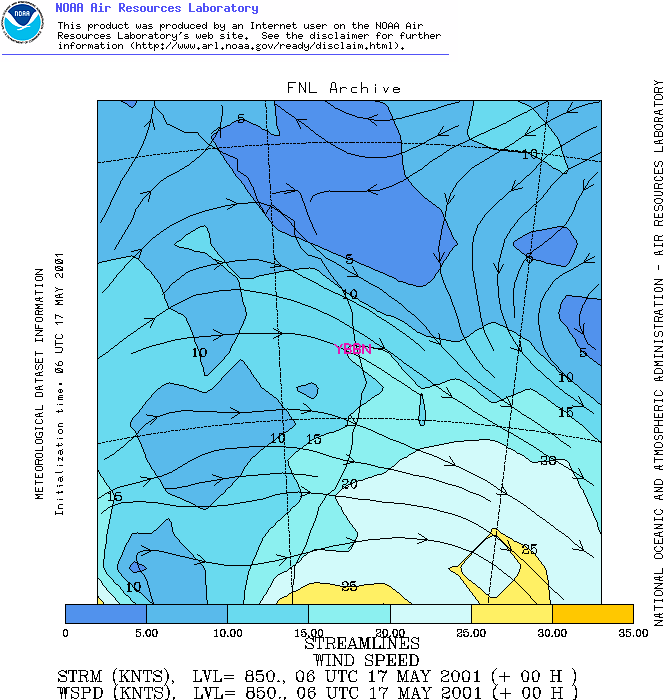
850 level is OK, around 10-15 knots...not fantastic, so the shear here hasn't done any favours to our little instability, so lets continue upwards!
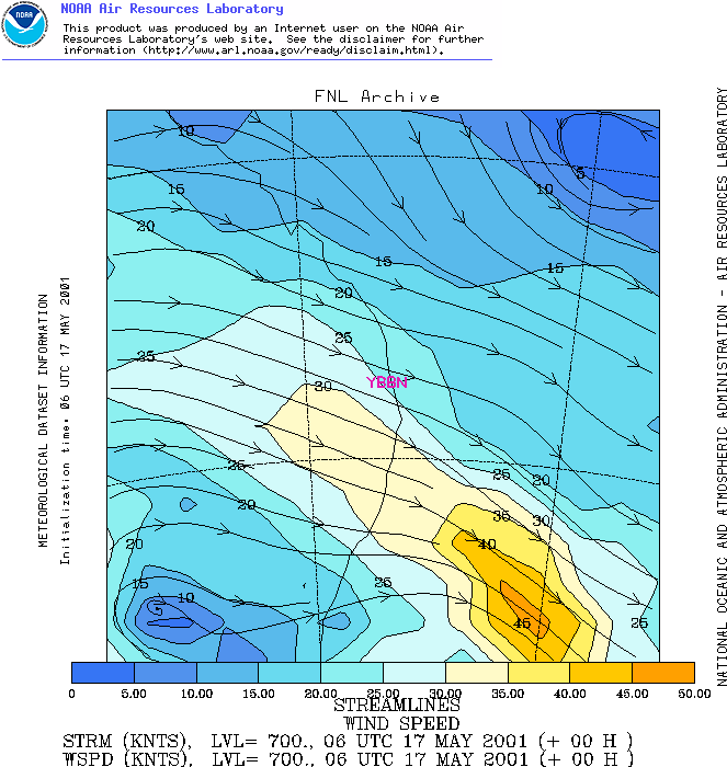
Ok, the 700 level is more favourable! 25-30 knot WNW'ly over us and 30 knots nearby...looking better! Lets continue!
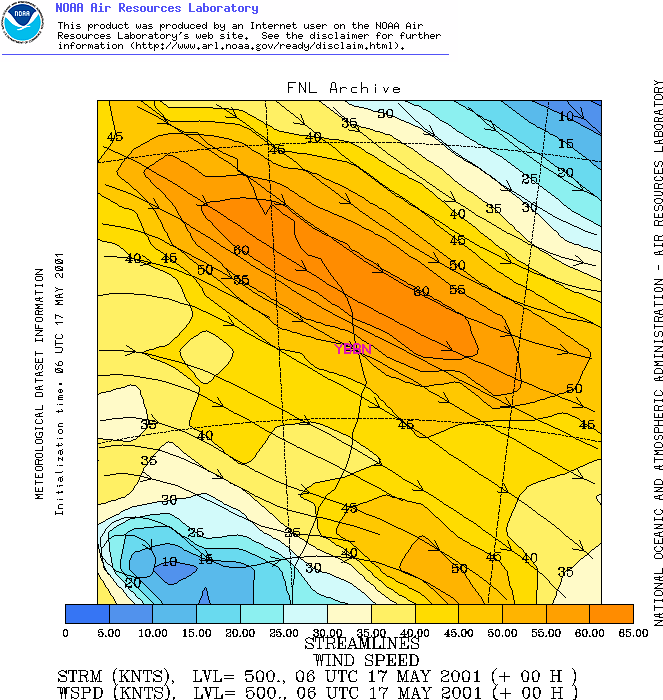
Now we're talking! Solid 50 knot jet over the region, stronger to the north though. Still, fairly reasonable and you can see now that we're also somewhat making up for the lower shear too - not just the instability! Lets have a look at the nice cold pool producing this too, you can see the closed circulation in the far SW of the plot, so we can probably expected a cold pool there, not just an upper trough!
Yep! Pretty close anyway, just west of the region (the geopotential heights would be slightly different). You can see that the strongest temperature gradient is just north of Brisbane too...no surprise that that is where our strongest get is! One more chart...
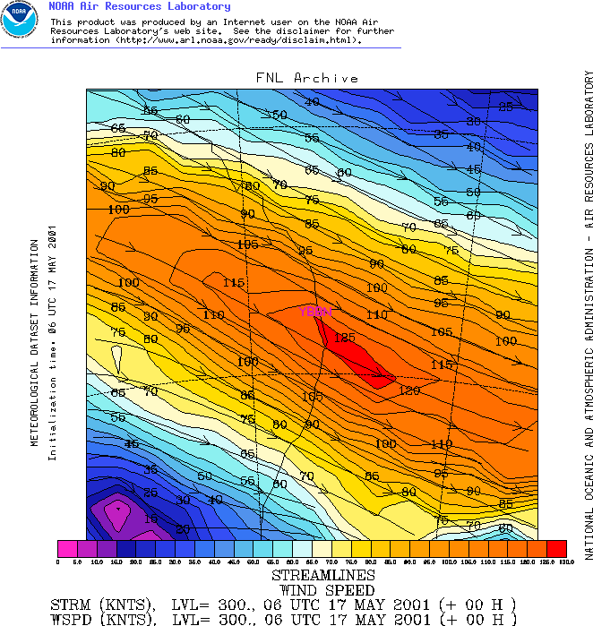
120 knots!!! Mega-strong...keep in mind
though that our storms probably wouldn't have reached that high!
Check the Skew-T, the instability ends at 400mb, so really a 400mb chart
would be more appropriate in this situation. Strong upper shear though
can assist in vorticity which helps lift the air, even if it doesn't directly
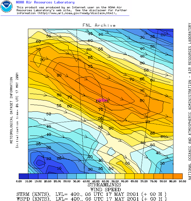
influence the updraft. So lets look at 400mb and think that it was
300mb...
80-85 knots, still some very nice shear! Most of the shear here was NW'ly, so not much in directional shear. Still, it managed to produce a nasty little storm. These are just situations that I went through in my chase reports and found them to be "not ideal" (well, remembered them to be). There are so many examples when you can have non-ideal situations, yet it becomes quite fruitful! It's not just a cut and dry situation where you look at instability and shear and say "there'll be this, this this and this" - much more complicated than this, and hopefully these 4 examples illustrate that to you. I have one more example though! And this time we're going to bump up the "odds" with OK instability and absolutely no shear! |