Severe Thunderstorms in Poor
Conditions
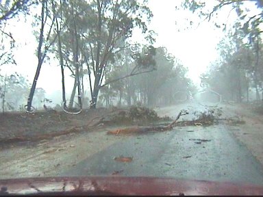
This is quite a good example of storms breaking the rules I think! One of the worst shear days in the history of storm chasing (almost...) producing some severe storms! There were a couple of factors for this. Once again I encourage you to check out the chase report of this day to get an idea on what happened (other than my car nearly having a tree fall on it in a rare treed area of the Downs!)
The setup...
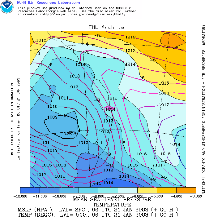
Yes I do look at MSL charts! I just haven't used them much in this guide, but I always look at MSLs too! Anyway...the charts showed a low through the eastern Warrego and western Maranoa regions, this was extending a trough across into the Downs, with most of the confluence developing over the western Downs. A weak general upper trough pushed into the region giving a broad region of instability. However moisture was becoming a problem, not so much surface moisture, but the moisture depth - it was getting a little shallow. So the ranges and elevated regions looked to be the best areas I thought. So lets look at instability...one thing that really made this work of the ranges was the fact that at 500m it was the same temperature as it was at the surface! So this really helped with the instability!
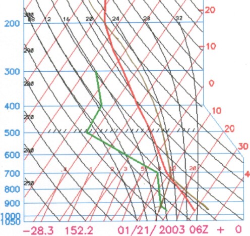
Even on the low resolution of an archived sounding you can already see the dry air in the low levels. The day didn't see much happen near sea level...most of it was along the ranges in the nearby area and on the Downs. Notice how high the LCL was too? A sig of dryness. Never the less, there's a reasonable amount of instability there! Not oodles and oodles, but pretty strong! Lets look at CAPE...
Not bad, 1700 is pretty good really! Although we'll need some shear to back that up. Interestingly, lets also calculate CAPE for around the sea level...I'll even compensate for some extra moisture by increasing the DP by a degree...
Nearly a 1000 CAPE deduction! So far it looks the ranges could be a good option, as we're going going to need every ounce of instability we can get...I'm sure you'll agree with me when you see shear.
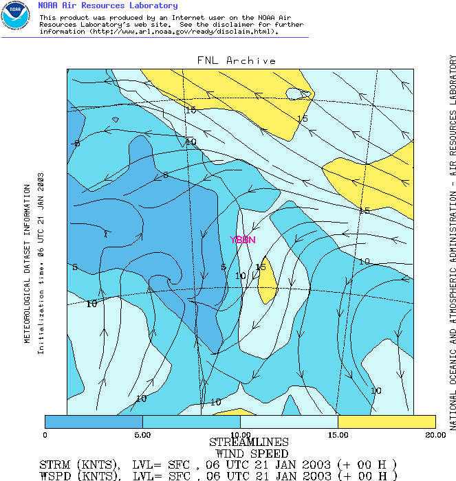
The surface flow wasn't too bad, 5-10 knot NNE'ly over the Downs (SW of Brisbane), once again I'm going to use the rigid scale I gave earlier to try and demonstrate how shear isn't always necessary. So this gives us a marginal surface flow.
Yick...not really what we were hoping to see, <5 knots (poor) over a broad area! No good, lets continue...
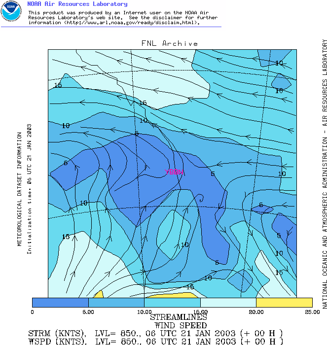
700 is certainly a bit more of an improvement! 20 knots or so (adequate), so things are suddenly looking up! Maybe we can compensate for the 850 levels as we go up! Lets see...
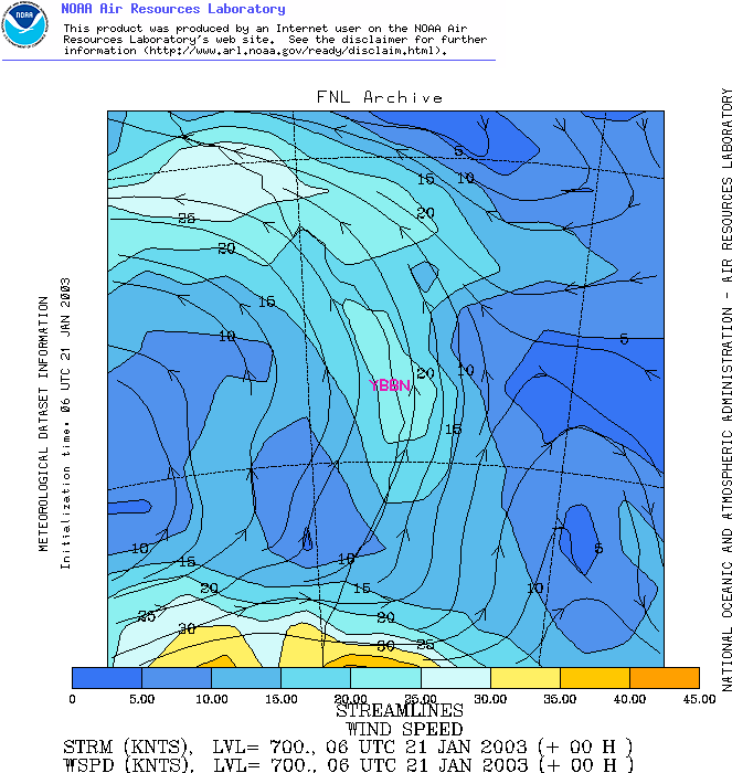
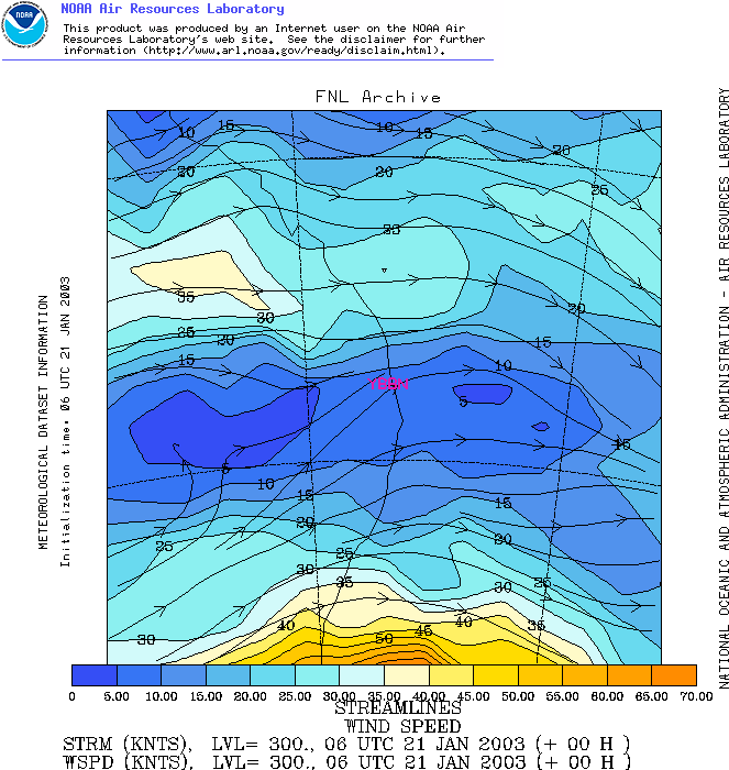
Right...well, after a brief bit of OK shear we've gone from bad to worse! 5-10 knots at 500mb (poor), this is looking hopeless!!!
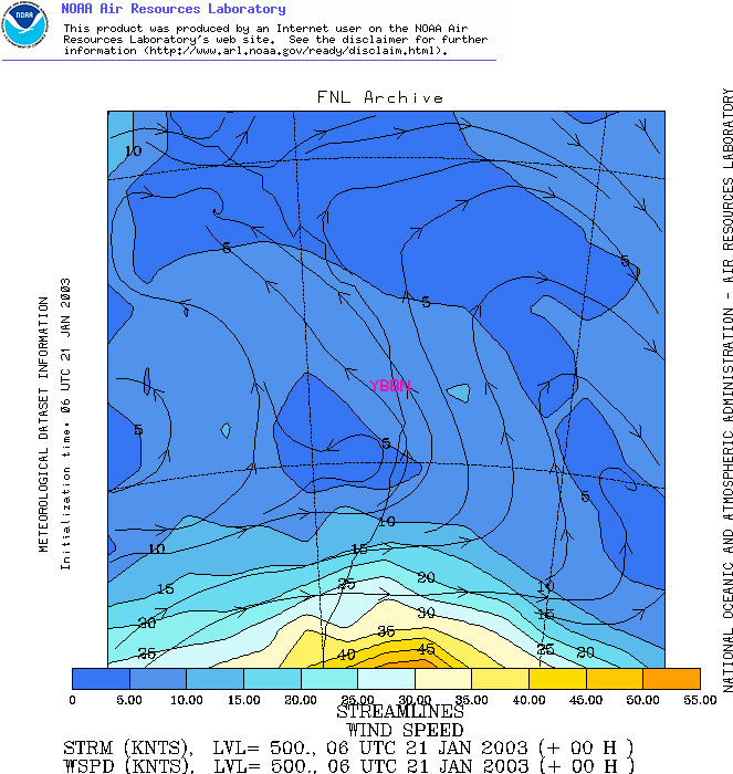
And again!!! Geez...why even bother chasing on this type of day??? I'll explain my madness soon...but lets summarize our shear! 1000mb - marginal (2)
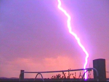
Total: 1.6 (poor-marginal) To put it bluntly...shear is hopeless. We do have some OK instability though, but how will that work with no shear? Well, this is partly where the dryness was going to give us an advantage (see, weather really does have no rules...after so much stuff on being concerned of it drying out, we find an area where the dryness actually helped us!) There a few reasons...the microbursts are no real mystery at all. Dry microbursts develop when rain evaporatively cools in the low-mid levels. You can see it's relatively dry in these levels, so we'd expect that to happen. As it cools, it's forced to sink (because it becomes heavier), but as it sinks it'll warm at the SALR (because it's saturated)...while the atmosphere around it warms at the ELR (which in dry situations is often the DALR). So once this parcel gets to the surface, it's going to be a LOT cooler than the surroundings! Remember how updrafts become really strong if they're significantly warmer than the surroundings? Downdrafts and microbursts are exactly the same - only opposite! (Does that make sense!) What I mean is, downdrafts that are significantly cooler than their surroundings will also be really strong. And once they hit the ground, there's no where for the air to go but spread out! I was standing on the edge of a dry microburst and nearly got blown over from the winds! (~115km/h!) The other thing dry air can help with is one of the reasons why storms like shear is it helps with organisation and it stops storms and updrafts from being "cluttered." If it is dry though, this will mean updrafts and upper moisture will evaporate into the surroundings, decreasing the chance for the situation to become cluttered! The last thing is - it really depends what you want. I wanted lightning (and I got it!) Dry air storms are normally good lightning produces, and if you check the chase report there's a few nice captures/photographs from it! Bottom line...what looked like a hopeless day was an enjoyable chase afternoon and evening! |